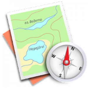
 Trekarta (former MapTrek) is designed for hiking, geocaching, off-roading, cycling, boating and all other outdoor activities.
It uses offline maps so you do not need to have internet connection. You can easily import places and tracks from GPX and KML data formats or create places in application and share them to others. It lets you write the track of your journey, even in background, so you will never get lost and be able later see where you've been.
Offline maps
Trekarta uses OpenStreetMap based vector maps that are lightweight, offline and are constantly enhanced by contributors. Maps contain detailed topological data with elevation contours. Some map elements can be filtered out for cleaner look. Trekarta has built-in hillshades support. You can add custom maps in sqlite or mbtiles format to cover your area of interest. Custom maps will be shaded as well. Such maps can be created by yourself with SAS.Planet application from mostly any online source or converted with MapTiler and other applications from other map formats.
Hiking
Special hiking activity mode emphasises paths and tracks on map. It visualizes path difficulty and visibility and displays hiking routes. It also displays special OSMC symbols that help you identify desired route.
Skiing and skating
Skiing activity mode displays clean winter map with mostly all skiing activities: downhill, nordic, hiking and touring. As a bonus freestyle snow-boarding, skating and sleighing areas are displayed.
Off-road
Unpaved, dirt, winter and ice roads are specially visualized. 4wd only roads have specific marking. Fords are displayed on all roads, even primary.
Places
Places can be easily imported from GPX and KML files or can be created within application. You can navigate to places and share them with others.
Tracks
Trekarta is designed to record tracks of your journey. Simply press a button when you start and press it once more when you finish. You can quit the application if you do not need to look at the map, the track will be recorded in the background.
Plugins
Trekarta functionality can be extended by plugins. Currently the following plugins are available:
• Location sharing
• Dropbox sync
More info
More information can be found at:
https://andreynovikov.info/tag/maptrek.html
WHAT'S NEW
• Fixed maps download on Android 12
• Fixed custom maps processing on device rotation
معلومات الحزمة:
Trekarta (former MapTrek) is designed for hiking, geocaching, off-roading, cycling, boating and all other outdoor activities.
It uses offline maps so you do not need to have internet connection. You can easily import places and tracks from GPX and KML data formats or create places in application and share them to others. It lets you write the track of your journey, even in background, so you will never get lost and be able later see where you've been.
Offline maps
Trekarta uses OpenStreetMap based vector maps that are lightweight, offline and are constantly enhanced by contributors. Maps contain detailed topological data with elevation contours. Some map elements can be filtered out for cleaner look. Trekarta has built-in hillshades support. You can add custom maps in sqlite or mbtiles format to cover your area of interest. Custom maps will be shaded as well. Such maps can be created by yourself with SAS.Planet application from mostly any online source or converted with MapTiler and other applications from other map formats.
Hiking
Special hiking activity mode emphasises paths and tracks on map. It visualizes path difficulty and visibility and displays hiking routes. It also displays special OSMC symbols that help you identify desired route.
Skiing and skating
Skiing activity mode displays clean winter map with mostly all skiing activities: downhill, nordic, hiking and touring. As a bonus freestyle snow-boarding, skating and sleighing areas are displayed.
Off-road
Unpaved, dirt, winter and ice roads are specially visualized. 4wd only roads have specific marking. Fords are displayed on all roads, even primary.
Places
Places can be easily imported from GPX and KML files or can be created within application. You can navigate to places and share them with others.
Tracks
Trekarta is designed to record tracks of your journey. Simply press a button when you start and press it once more when you finish. You can quit the application if you do not need to look at the map, the track will be recorded in the background.
Plugins
Trekarta functionality can be extended by plugins. Currently the following plugins are available:
• Location sharing
• Dropbox sync
More info
More information can be found at:
https://andreynovikov.info/tag/maptrek.html
WHAT'S NEW
• Fixed maps download on Android 12
• Fixed custom maps processing on device rotation
معلومات الحزمة:
هذا التطبيق لديه No الإعلانات
لقطات الشاشة
[appbox googleplay id=mobi.maptrek]
التحميلات
Trekarta - offline maps for outdoor activities v2022.05 build 85 [Paid] APK / مرآة
النسخة الأقدم
Trekarta - offline maps for outdoor activities v2022.05 [Paid] APK / مرآة
Trekarta - offline maps for outdoor activities v2022.04 [Paid] APK / مرآة

Trekarta – offline maps for outdoor activities v2022.05 build 85 [Paid] APK [Latest]
| اسم | |
|---|---|
| الناشر | |
| النوع | تطبيقات الأندرويد |
| إصدار | |
| تحديث | - |
| تقرير | تطبيقات التقارير |

Trekarta (former MapTrek) is designed for hiking, geocaching, off-roading, cycling, boating and all other outdoor activities.
It uses offline maps so you do not need to have internet connection. You can easily import places and tracks from GPX and KML data formats or create places in application and share them to others. It lets you write the track of your journey, even in background, so you will never get lost and be able later see where you’ve been.
Offline maps
Trekarta uses OpenStreetMap based vector maps that are lightweight, offline and are constantly enhanced by contributors. Maps contain detailed topological data with elevation contours. Some map elements can be filtered out for cleaner look. Trekarta has built-in hillshades support. You can add custom maps in sqlite or mbtiles format to cover your area of interest. Custom maps will be shaded as well. Such maps can be created by yourself with SAS.Planet application from mostly any online source or converted with MapTiler and other applications from other map formats.
Hiking
Special hiking activity mode emphasises paths and tracks on map. It visualizes path difficulty and visibility and displays hiking routes. It also displays special OSMC symbols that help you identify desired route.
Skiing and skating
Skiing activity mode displays clean winter map with mostly all skiing activities: downhill, nordic, hiking and touring. As a bonus freestyle snow-boarding, skating and sleighing areas are displayed.
Off-road
Unpaved, dirt, winter and ice roads are specially visualized. 4wd only roads have specific marking. Fords are displayed on all roads, even primary.
Places
Places can be easily imported from GPX and KML files or can be created within application. You can navigate to places and share them with others.
Tracks
Trekarta is designed to record tracks of your journey. Simply press a button when you start and press it once more when you finish. You can quit the application if you do not need to look at the map, the track will be recorded in the background.
Plugins
Trekarta functionality can be extended by plugins. Currently the following plugins are available:
• Location sharing
• Dropbox sync
More info
More information can be found at:
https://andreynovikov.info/tag/maptrek.html
ما هو الجديد
• Fixed maps download on Android 12
• Fixed custom maps processing on device rotation
معلومات الحزمة:
- اللغات: لغات متعددة كاملة؛
- وحدات المعالجة المركزية: Armeabi-v7a، Arm64-v8a، x86، x86_64؛
- DPIs للشاشة: 120 نقطة لكل بوصة، 160 نقطة لكل بوصة، 240 نقطة لكل بوصة، 320 نقطة لكل بوصة، 480 نقطة لكل بوصة، 640 نقطة لكل بوصة؛
- ملف APK لم يمس مع توقيع التجزئة الأصلي، ولم يتم تطبيق [Mod] أو تغييرات؛
- Certificate MD5 digest: 2b3b3ecfb5b7387484b01a51fd6a948f
هذا التطبيق لديه No الإعلانات
لقطات الشاشة


التحميلات
Trekarta – offline maps for outdoor activities v2022.05 build 85 [Paid] APK / مرآة
النسخة الأقدم
Trekarta – offline maps for outdoor activities v2022.05 [Paid] APK / مرآة
Trekarta – offline maps for outdoor activities v2022.04 [Paid] APK / مرآة
Download Trekarta – offline maps for outdoor activities v2022.05 build 85 [Paid] APK [Latest]
أنت الآن جاهز للتنزيل مجانا. وهنا بعض الملاحظات:
- يرجى مراجعة دليل التثبيت لدينا.
- للتحقق من وحدة المعالجة المركزية ووحدة معالجة الرسومات لجهاز Android، يرجى استخدام وحدة المعالجة المركزية-Z برنامج