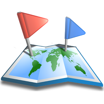
Convert your phone into the most powerful GPS for Android Powered Devices with GPS Waypoints Navigator. Whether you are navigating to a waypoint in the wilderness or in the city, GPS Waypoints Navigator will help you find the way.
★ Typical Useage:
Trail Hiking and Track Recording.
Offroad Navigation.
Marine Navigation.
Camping / Orienteering.
City and wilderness exploration.
Geocacheing
With dozens of options for navigating the back-country, waterways and roadways, the tool set found in this software package will quickly become your best friend. Venture beyond network reach using offline maps and tools that only require a good view of the sky. Share important location data with friends who will be able to navigate to your favorite waypoints and find your favorite trails. Get:
★ Unlimited access to our vector map library with over 400 maps. Download maps for offline use. Transfer maps to your SD card to free-up internal memory.
★ No recurring costs or subscription fees. Everything is included with your original purchase.
★ Waypoint and trail management systems.
★ Waypoint search.
★ Waypoint file system.
★ Waypoint photography.
★ Maps! Choose from multiple sources: Downloadable Vector Maps, Topo Maps, Google Maps, Satellite Maps, OpenStreetMaps- MapNik, Mapquest, Cycling Maps OpenSeaMap, USGS Topo Maps, Canada Toporama, Trail Hiking and Biking, NOAA Nautical Charts.
★ KML, KMZ & GPX file importing and exporting for trails and waypoints. Share data and view in Google Earth.
★ Exported GPX files may be uploaded to freelogbook.biz for company route tracking.
★ A panel for all your GPS parameters.
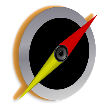
★ Navigational compasses.
★ Trail recorder.
★ Military coordinate finder
★ Several waypoint creation tools: Enter coordinates, set a waypoint by tapping on a map, save your current position or enter an address (voice entry supported).
★ Two Waypoint Guidance Systems including a dynamic waypoint compass that always points to your target and a new navigation concept- GPS Reflected Pseudo-Radar (available only from DS Software).
★ Map Search: Supports entry of addresses and coordinates in just about any format including UTM and MGRS.
★ Satellite reports and graphs
★ Email a map of your position. Navigation software not required on recipient's device.
★ Seamless integration with Google Earth.
★ Marine Navigation. Features NOAA Nautical Charts, OpenSeaMap and nautical unit reporting.
★ Supports several coordinate formats: Latitude/Longitude as degrees, deg:min or deg:min:sec, UTM, MGRS.
★ Proximity alerts.
★ Altitude profiling determined from your position matched to altitude values in land survey databases providing you with values that are more reliable than altitude values returned from your device's GPS chip.
★ Map with floating reticule that shows your position with bearing and distance to reticule.
★ Sunrise Sunset report- Does not require a network connection. Useful for planning expedition turn around time or time to make camp.
★ Data is backed up allowing battery change without data loss.
Also get:
- Turn-by-turn driving directions and driving maps.
- You decide how compasses are controlled- By GPS or magnetically. Use magnetic control for indoors, underground or in caves.
- Detailed Help file
- Excellent customer service
- Supports multiple languages: English, Spanish, German, Portuguese, Japanese, French, Italian, Russian, Chinese (traditional and simplified).
With GPS Waypoints Navigator, every navigation experience will be as easy as a walk in the park!
★ Recent Additions ★
- GPX, KML AND KMZ FILE HANDLING. EXPORT YOUR TRACKS AS A GPX FILE AND USE IT TO HELP BUILD OPENSTREETMAP. IMPORT GPX FILES FROM GARMIN. KML FILES ARE BEST FOR VIEWING IN GOOGLE EARTH.
- WAYPOINT PHOTOGRAPHY
- MAP SEARCH
- ALTITUDE SUPPORT: Choose Satellite, United States Geologic Survey location based altitude or SRTM data. USGS available only in contiguous U.S.A, Canada and Mexico.
What's New:
1. Fixed Android 10 compatibility issues with vector maps and Google maps.
2. New set of maps with expanded capabilities.
3. Draw all your trails on one map (Google map types only).
Cette application n'a aucune publicité
Captures d'écran
[appbox googleplay id=com.discipleskies.android.gpswaypointsnavigator]
Téléchargements
Convert your phone into the most powerful GPS for Android Powered Devices with GPS Waypoints Navigator. Whether you are navigating to a waypoint in the wilderness or in the city, GPS Waypoints Navigator will help you find the way.
★ Typical Useage:
Trail Hiking and Track Recording.
Offroad Navigation.
Marine Navigation.
Camping / Orienteering.
City and wilderness exploration.
Geocacheing
With dozens of options for navigating the back-country, waterways and roadways, the tool set found in this software package will quickly become your best friend. Venture beyond network reach using offline maps and tools that only require a good view of the sky. Share important location data with friends who will be able to navigate to your favorite waypoints and find your favorite trails. Get:
★ Unlimited access to our vector map library with over 400 maps. Download maps for offline use. Transfer maps to your SD card to free-up internal memory.
★ No recurring costs or subscription fees. Everything is included with your original purchase.
★ Waypoint and trail management systems.
★ Waypoint search.
★ Waypoint file system.
★ Waypoint photography.
★ Maps! Choose from multiple sources: Downloadable Vector Maps, Topo Maps, Google Maps, Satellite Maps, OpenStreetMaps- MapNik, Mapquest, Cycling Maps OpenSeaMap, USGS Topo Maps, Canada Toporama, Trail Hiking and Biking, NOAA Nautical Charts.
★ KML, KMZ & GPX file importing and exporting for trails and waypoints. Share data and view in Google Earth.
★ Exported GPX files may be uploaded to freelogbook.biz for company route tracking.
★ A panel for all your GPS parameters.
★ Navigational compasses.
★ Trail recorder.
★ Military coordinate finder
★ Several waypoint creation tools: Enter coordinates, set a waypoint by tapping on a map, save your current position or enter an address (voice entry supported).
★ Two Waypoint Guidance Systems including a dynamic waypoint compass that always points to your target and a new navigation concept- GPS Reflected Pseudo-Radar (available only from DS Software).
★ Map Search: Supports entry of addresses and coordinates in just about any format including UTM and MGRS.
★ Satellite reports and graphs
★ Email a map of your position. Navigation software not required on recipient's device.
★ Seamless integration with Google Earth.
★ Marine Navigation. Features NOAA Nautical Charts, OpenSeaMap and nautical unit reporting.
★ Supports several coordinate formats: Latitude/Longitude as degrees, deg:min or deg:min:sec, UTM, MGRS.
★ Proximity alerts.
★ Altitude profiling determined from your position matched to altitude values in land survey databases providing you with values that are more reliable than altitude values returned from your device's GPS chip.
★ Map with floating reticule that shows your position with bearing and distance to reticule.
★ Sunrise Sunset report- Does not require a network connection. Useful for planning expedition turn around time or time to make camp.
★ Data is backed up allowing battery change without data loss.
Also get:
- Turn-by-turn driving directions and driving maps.
- You decide how compasses are controlled- By GPS or magnetically. Use magnetic control for indoors, underground or in caves.
- Detailed Help file
- Excellent customer service
- Supports multiple languages: English, Spanish, German, Portuguese, Japanese, French, Italian, Russian, Chinese (traditional and simplified).
With GPS Waypoints Navigator, every navigation experience will be as easy as a walk in the park!
★ Recent Additions ★
- GPX, KML AND KMZ FILE HANDLING. EXPORT YOUR TRACKS AS A GPX FILE AND USE IT TO HELP BUILD OPENSTREETMAP. IMPORT GPX FILES FROM GARMIN. KML FILES ARE BEST FOR VIEWING IN GOOGLE EARTH.
- WAYPOINT PHOTOGRAPHY
- MAP SEARCH
- ALTITUDE SUPPORT: Choose Satellite, United States Geologic Survey location based altitude or SRTM data. USGS available only in contiguous U.S.A, Canada and Mexico.
What's New:
1. Fixed Android 10 compatibility issues with vector maps and Google maps.
2. New set of maps with expanded capabilities.
3. Draw all your trails on one map (Google map types only).
Cette application n'a aucune publicité
Captures d'écran
[appbox googleplay id=com.discipleskies.android.gpswaypointsnavigator]
Téléchargements
GPS Waypoints Navigator v9.19 [Paid] APK / Miroir
Ancienne version
GPS Waypoints Navigator v9.16 [Paid] APK / Miroir
GPS Waypoints Navigator v9.11 [Paid] APK / Miroir
GPS Waypoints Navigator v9.19 [Paid] APK [Latest]
| Nom | |
|---|---|
| Éditeur | |
| Genre | Applications Android |
| Version | |
| Mise à jour | - |
| Rapport | Applications de rapport |

Convert your phone into the most powerful GPS for Android Powered Devices with GPS Waypoints Navigator. Whether you are navigating to a waypoint in the wilderness or in the city, GPS Waypoints Navigator will help you find the way.
★ Typical Useage:
Trail Hiking and Track Recording.
Offroad Navigation.
Marine Navigation.
Camping / Orienteering.
City and wilderness exploration.
Geocacheing
With dozens of options for navigating the back-country, waterways and roadways, the tool set found in this software package will quickly become your best friend. Venture beyond network reach using offline maps and tools that only require a good view of the sky. Share important location data with friends who will be able to navigate to your favorite waypoints and find your favorite trails. Get:
★ Unlimited access to our vector map library with over 400 maps. Download maps for offline use. Transfer maps to your SD card to free-up internal memory.
★ No recurring costs or subscription fees. Everything is included with your original purchase.
★ Waypoint and trail management systems.
★ Waypoint search.
★ Waypoint file system.
★ Waypoint photography.
★ Maps! Choose from multiple sources: Downloadable Vector Maps, Topo Maps, Google Maps, Satellite Maps, OpenStreetMaps- MapNik, Mapquest, Cycling Maps OpenSeaMap, USGS Topo Maps, Canada Toporama, Trail Hiking and Biking, NOAA Nautical Charts.
★ KML, KMZ & GPX file importing and exporting for trails and waypoints. Share data and view in Google Earth.
★ Exported GPX files may be uploaded to freelogbook.biz for company route tracking.
★ A panel for all your GPS parameters.
★ Navigational compasses.
★ Trail recorder.
★ Military coordinate finder
★ Several waypoint creation tools: Enter coordinates, set a waypoint by tapping on a map, save your current position or enter an address (voice entry supported).
★ Two Waypoint Guidance Systems including a dynamic waypoint compass that always points to your target and a new navigation concept- GPS Reflected Pseudo-Radar (available only from DS Software).
★ Map Search: Supports entry of addresses and coordinates in just about any format including UTM and MGRS.
★ Satellite reports and graphs
★ Email a map of your position. Navigation software not required on recipient’s device.
★ Seamless integration with Google Earth.
★ Marine Navigation. Features NOAA Nautical Charts, OpenSeaMap and nautical unit reporting.
★ Supports several coordinate formats: Latitude/Longitude as degrees, deg:min or deg:min:sec, UTM, MGRS.
★ Proximity alerts.
★ Altitude profiling determined from your position matched to altitude values in land survey databases providing you with values that are more reliable than altitude values returned from your device’s GPS chip.
★ Map with floating reticule that shows your position with bearing and distance to reticule.
★ Sunrise Sunset report- Does not require a network connection. Useful for planning expedition turn around time or time to make camp.
★ Data is backed up allowing battery change without data loss.
Also get:
– Turn-by-turn driving directions and driving maps.
– You decide how compasses are controlled- By GPS or magnetically. Use magnetic control for indoors, underground or in caves.
– Detailed Help file
– Excellent customer service
– Supports multiple languages: English, Spanish, German, Portuguese, Japanese, French, Italian, Russian, Chinese (traditional and simplified).
With GPS Waypoints Navigator, every navigation experience will be as easy as a walk in the park!
★ Recent Additions ★
– GPX, KML AND KMZ FILE HANDLING. EXPORT YOUR TRACKS AS A GPX FILE AND USE IT TO HELP BUILD OPENSTREETMAP. IMPORT GPX FILES FROM GARMIN. KML FILES ARE BEST FOR VIEWING IN GOOGLE EARTH.
– WAYPOINT PHOTOGRAPHY
– MAP SEARCH
– ALTITUDE SUPPORT: Choose Satellite, United States Geologic Survey location based altitude or SRTM data. USGS available only in contiguous U.S.A, Canada and Mexico.
Quoi de neuf:
1. Fixed Android 10 compatibility issues with vector maps and Google maps.
2. New set of maps with expanded capabilities.
3. Draw all your trails on one map (Google map types only).
Cette application n'a aucune publicité
Captures d'écran


Téléchargements
Ancienne version
Download GPS Waypoints Navigator v9.19 [Paid] APK [Latest]
Vous êtes maintenant prêt à télécharger gratuitement. Voici quelques remarques :
- Veuillez consulter notre guide d'installation.
- Pour vérifier le CPU et le GPU de l'appareil Android, veuillez utiliser CPU-Z application